
Helicopter survey work to support river management
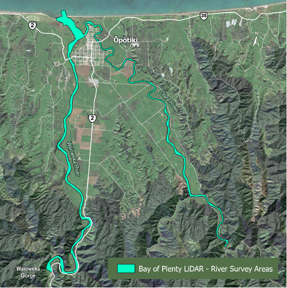
Bay of Plenty Regional Council is planning aerial survey work over several rivers in the Eastern Bay of Plenty.
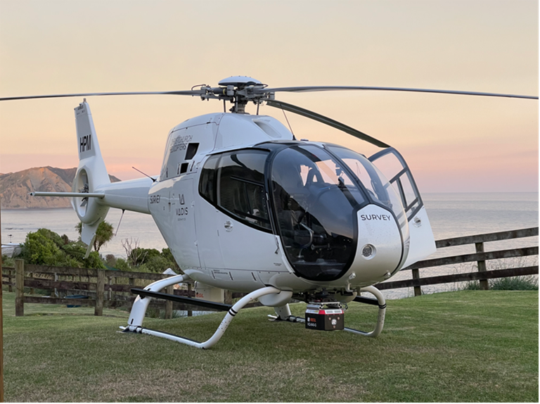
The work will involve a helicopter flying at low altitude (approximately 150 metres) along sections of river channels and margins. The helicopter will be fitted with specialist LiDAR survey equipment used to map river systems.
Niroy Sumeran, Project Engineering Team Leader, at Regional Council says the technology will provide more detailed and accurate information to support river management.
“This work helps us better understand how our rivers function, which is critical for understanding river behaviour, maintaining assets, and protecting people and the environment.”
Bathymetric LiDAR is an emerging technology that has been used in other parts of Aotearoa and is now being applied to key rivers in the Bay of Plenty.
People in affected areas, including parts of Opotiki township, may notice the helicopter operating at low altitude for short periods.
The helicopter will be operated by Vadis Geomatics and will be visible on public flight tracking services under that name.
Ground-based survey work will also be carried out alongside the aerial survey.
Weather permitting, the work is expected to be completed over a short timeframe during the week, Monday 18 May – Friday 22 May.